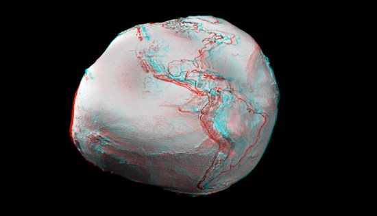
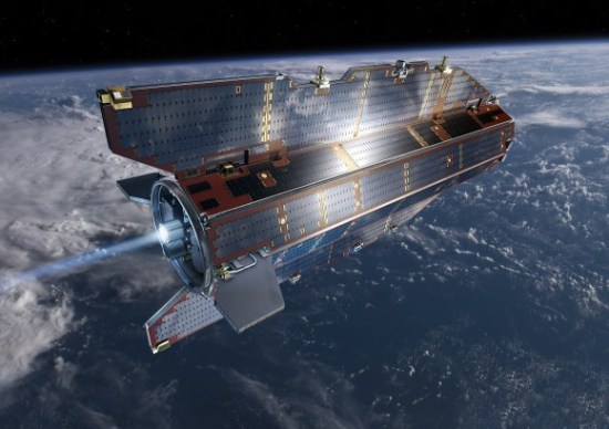
New satellite imaging from the Gravity field and steady-state Ocean Circulation Explorer, GOCE for short, has given us a much more detailed picture of Earth’s gravity field, and thus a more accurate knowledge of the planet’s geoid. The geoid is basically a depiction of the planet devoid of land masses, where the planet is pure ocean, shaped by the gravitational field. It’s pretty lumpy. After all, Earth is by no means a perfect ellipse, so the planet’s gravitational field isn’t either.
The image below is representative of our current knowledge, and a much more detailed version will be able to be created from the GOCE’s data. The image above was the result of only two months of gathering, so in a short time we will have an even more detailed sense of the Earth’s gravitational field and be able to create an analglyph better than that below.

See? Lumpy.
We have been able to understand previously that gravity is different for you based on where on the planet you stand. Those on the poles feel different gravity than they would at the equator, and people on mountains feel less gravity than those at or below sea level, being farther from the planet’s core. This new data supplies knowledge for the third factor in varying gravity: The actual mass and density of the part of the planet immediately beneath you. And it does so with incredibly sensitive imaging technology.
The GOCE satellite can measure accelerations as small as 1 part in 10 trillion of the gravity experienced on Earth. And because this technology requires no disturbance to function properly, the entire satellite is literally just one giant measuring device.

Universe Today reports on how many different parts of the Earth will be better mapped by this satellite:
“The computed global gravity field looks very promising. We can already see that important new information will be obtained for large areas of South America, Africa, Himalaya, South-East Asia and Antarctica,” said Prof. Reiner Rummel from Technische Universität München, Chairman of the GOCE Mission Advisory Group. “With each two-month cycle of data, the gravity model will become more detailed and accurate. I am convinced that the data will be of great interest to various disciplines of Earth sciences.”
Probably the most significant science it will impact is that of climate change, for which better ocean data will prove instrumental.
(Via Universe Today)


Published: Jun 29, 2010 12:51 pm